
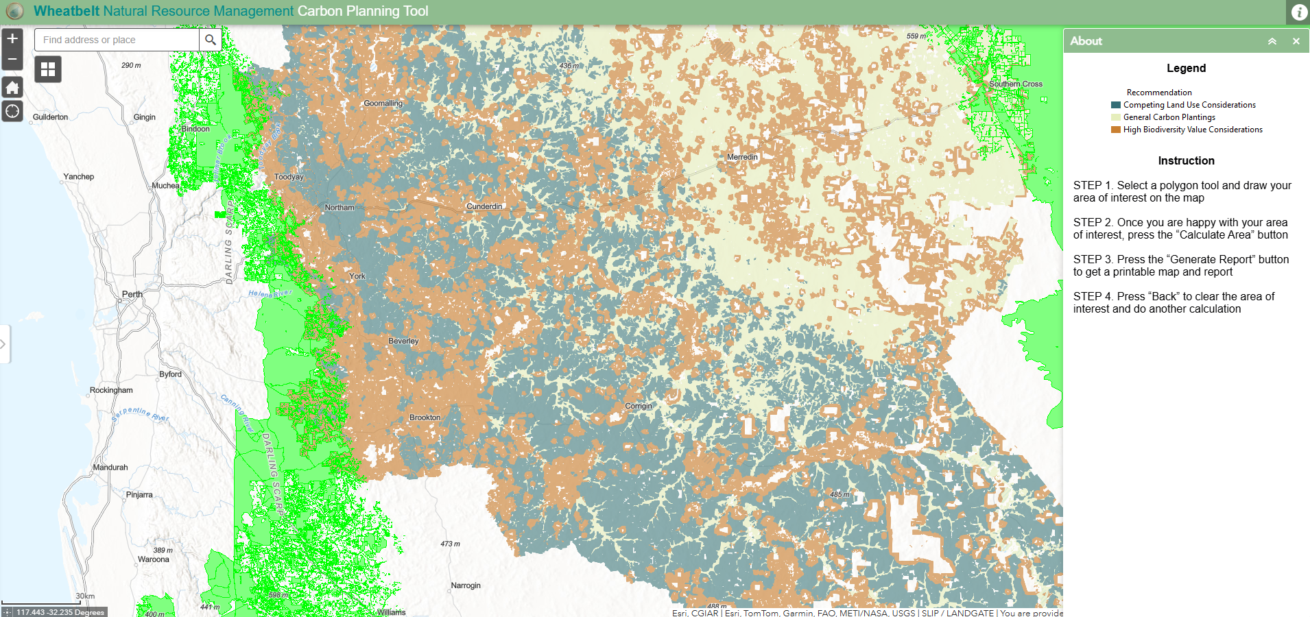
Carbon Planning Tool
This tool is designed for landholders to guide carbon planting activities on their properties.
Planning for carbon sequestration is one of the five-year strategic priorities under the objective of adapting to climate change within the Regional NRM Strategy for the Avon River Basin. Using funding from the Australian Government, Wheatbelt NRM engaged Ecoscape to carry out an analysis of carbon sequestration opportunities in the region culminating in the development of the Carbon Planning Tool (hyperlink to the tool). The tool has been designed for use by Wheatbelt landholders to aid in planning carbon activities on their properties.
In order to identify suitable carbon activities for the range of landscapes across the region, the analysis focussed on identifying three types of landscapes;
1. Landscapes that need to be protected from carbon plantings; i.e. high quality agricultural land, high value water/groundwater resources, conservations zones, protected Aboriginal cultural sites and remnant vegetation.
2. Areas to encourage planting; i.e. potential salinity areas, water resources recovery catchments, low value agricultural lands, areas with low socio-economic resilience, potential climate stress areas and cleared land and;
3. Landscapes where we want carbon plantings to enhance habitat corridors and protect high quality biodiversity area; i.e. high value biodiversity areas, habitat corridors, rivers and buffer zones.
How to use the tool
Use the search bar at the top right of the map to navigate your address or area of interest.
Use the “Area of interest” tool to draw a polygon around the area where you are interested in undertaking carbon activities – it might be a paddock or your whole property.
The tool generates a report that shows the proportion (area in hectares) of your area of interest that falls under three recommended carbon activities in the area; competing landuse considerations, general carbon plantings and high biodiversity considerations.